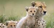
Periyar National Park, Kerala
Periyar National Park and Wildlife Sanctuary (PNP) is a protected area in the districts of Idukki and Pathanamthitta in Kerala, south India. It is notable as an elephant reserve and a tiger reserve. The protected area covers an area of 925 km2 (357 sq mi). 350 km2 (140 sq mi) of the core zone was declared as the Periyar National Park in 1982.
The park is often called the Periyar Wildlife Sanctuary. It is also referred to by the name "Thekkady". It is set high in the Cardamom Hills and Pandalam Hills of the southern Western Ghats along the border with Tamil Nadu state. The park is located 4 km (2.5 mi) from Kumily, approximately 100 km (62 mi) east ofKottayam, 110 km (68 mi) west of Madurai and 120 km (75 mi) southeast ofKochi.

History
-
1895 - Construction of the Mullaperiyar Dam
-
1899 - Formation of the Periyar Lake Reserve
-
1933 - S.C.H. Robinson made the first game warden
-
1934 - Formation of Nellikkampatty Game Sanctuary
-
1950 - Consolidation of Periyar as a Wildlife sanctuary
-
1978 - Declaration of Periyar as a Tiger Reserve
-
1982 - Preliminary notification of the core area as a National Park
-
1991 - Brought under Project Elephant
-
1996 - India Ecodevelopment Project launched
-
2001 - Reorganised as two Divisions: Periyar East and Periyar West
-
2004 – Formation of Periyar Foundation
-
2007 – Adding of 148 km2 from Goodrical Range of Ranni Division.
The Periyar tiger reserve is considered as one of the best managed reserve in India. The core zone of the park is not accessible to the tourists. Within the buffer zone of 430 km², a zone of 55 km² is kept apart for tourism. Game wardens and staff have been recently spotted illegally fishing and gathering specimens within the sanctuary area. The facilities within the sanctuary are in need of much maintenance and are presently in very poor standards. This has also contributed a steady decline in returning tourists to the sanctuary.
In the buffer zone there is also the temple of Sabarimala, which is visited by about 4 millionpilgrims annually.
It's important to recognize, however, that for the very purpose of protecting its wildlife and shielding them from human interference, Periyar National Park allows extremely limited access to the territory under its jurisdiction, restricting tourist entry only to the northern corner adjacent to man-made lake Periyar.
Tourists and Pilgrims
Flora
Approximately 75% of the entire protected area are covered of unaffected evergreen or semi-evergreen rain forest. There typically tall tropical tree species such as Vateria indica,Cullenia exarillata, Hopea parviflora, Canarium strictum, Artocarpus hirsutus and Bischofia javanicaare seen. They reach heights of 40 to 50 Metres.
Scarcely 13% consists of damp leaves forest, 7% of Eucalyptus plantation and 1.5% of grassland. The remainder (around 3.5%) of the protected area is covered by the Periyar artificial lake as well as the Periyar River and Pamba rivers.
Altogether the reservation counts nearly 2000 kinds of flowering plants (Angiosperms), three kinds of seed plants (gymnosperms) and 170 different species of ferns. Among the Angiosperms, there are 169 families of sweet grasses and 155 kinds of Fabaceae. Orchids, with 145 representative types, are the most frequent flower.
About 350 of the occurring plant types can be used for medical purposes.
Geography
The Periyar protected area lies in the middle of a mountainous area of theCardamom Hills. In the north and the east it is bounded by mountain ridges of over 1,700 m (5,600 ft) altitude and toward the west it expands into a 1,200 metres (3,900 ft) high plateau. From this level the altitude drops steeply to the deepest point of the reserve, the 100 metre valley of thePamba River. The highest peak is the 2,019 m (6,624 ft) high Kottamalai. The longest river in Kerala, the Periyar originates from the forests of the Periyar Tiger Reserve as does the holy river of Pamba.
The sanctuary surrounds picturesque 26 km2 (10 sq mi) Periyar lake, formed by the building of Mullaperiyar Dam in 1895. This reservoir and the Periyar River meander around the contours of the wooded hills, providing a permanent source of water for the local wildlife.
Climate
The temperature varies depending upon the altitude and it ranges between 15° Celsius in December and January and 31° Celsius in April and May. The annual amount of precipitation lies between 2000 and 3000 mm. About two thirds of the precipitation occurs during the southwest monsoon between June to September. A smaller amount of precipitation occurs during the northeast monsoon between October and December.


